Real Estate
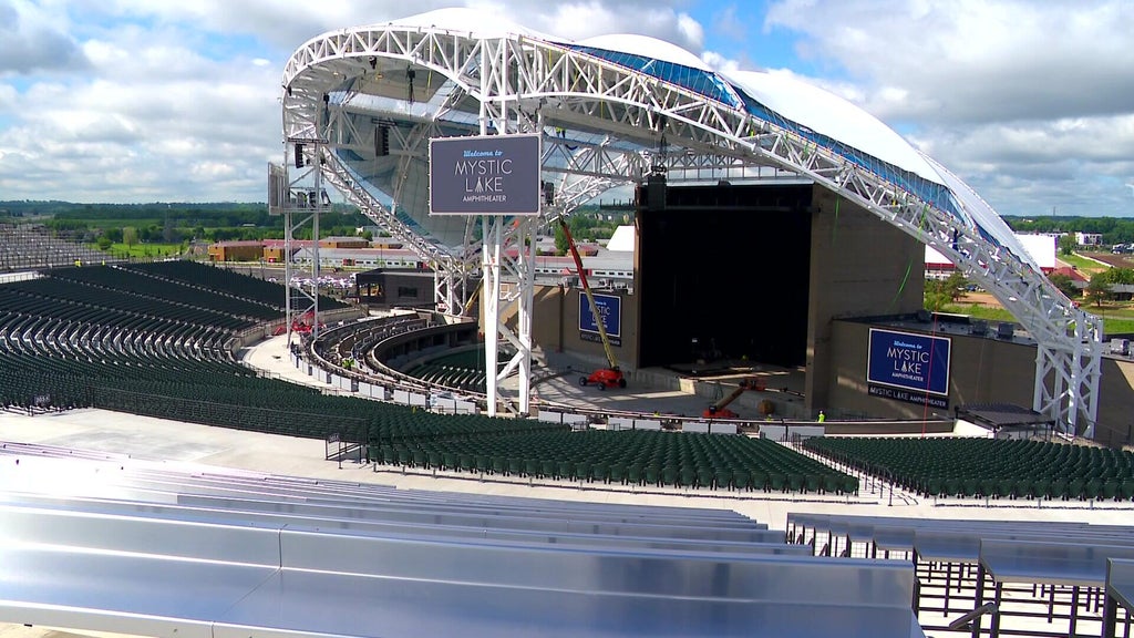
Shakopee officials approve hiring firm to study Mystic Lake Amphitheater noise
By Katherine Langford
Advertisement · Why this ad?
Marcus manages the day-to-day editorial workflow across all brands, coordinating coverage assignments and ensuring editorial standards are met. He previously served as city editor at the Pioneer Press and holds a degree in Political Science from Carleton College.
More from Marcus →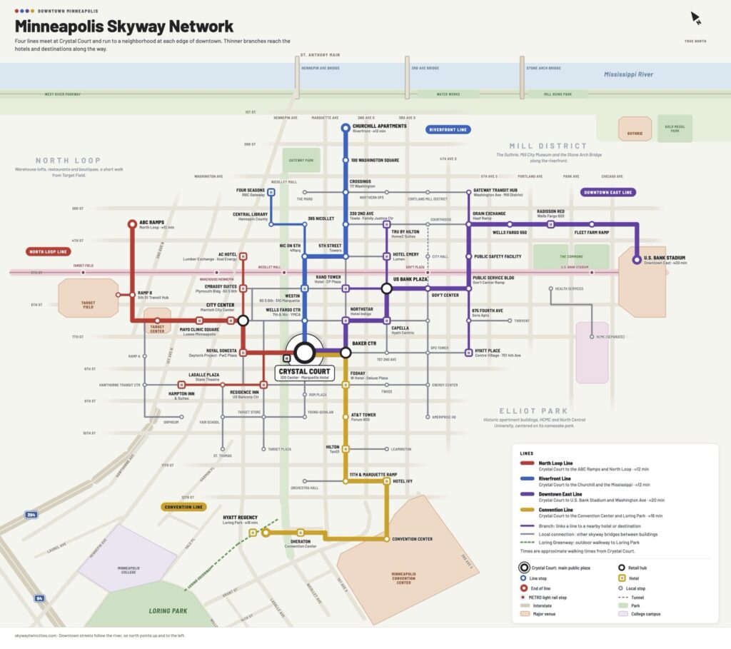
Guest Commentary Minneapolis Skyways Need A Better Map Minneapolis has never decided what the skyway system is actually for. So I started with a map. By Ed Smelser November 12, 2026 Ask almost anyone working on downtown Minneapolis’s recovery about our skyways and the answer comes back as a leasing problem. Too many dark storefronts on the second level; the seemingly obvious fix is to fill them. I see the appeal – landlords desperately need that rent. But the belief that our skyways should keep doing the job they did in 1995, when downtown had a captive daytime workforce and retail with nowhere else to go, is the belief that keeps the system stuck. The 90s aren’t coming back – and neither is that version of downtown. The city is putting real money into reviving the street, from the rebuilt Nicollet Mall to the office towers now becoming apartments, and the skyways compete with that investment for the same shoppers and the same small businesses. Eric Dayton famously argued that splitting foot traffic between two levels leaves a city with two struggling retail environments instead of one healthy one. It’s hard to look at either level today and say he was wrong. I’m not arguing for tearing them down. Nearly ten miles of climate-controlled walkway connecting roughly 80 blocks – no other American downtown has this . What Minneapolis has never done is decide what the system is actually for. So I started with a map. One Hub, Four Lines Today’s skyway maps may be accurate, but they’re nearly useless to the person standing at a bridge trying to decide which way to turn. Every connection gets equal weight, which creates an endless maze. A visitor leaving the Hilton for a Timberwolves game has no way to tell which route will still be open at 7 p.m., or what the fastest way is to get there. On a METRO map, a colored line means a train will come. Our skyways should work the same way. The map starts at IDS Center’s Crystal Court – in practice already the hub, since the IDS Center connects in every direction and is large enough to serve as a staffed public plaza. From there, four color-coded lines run to the edges of downtown: The North Loop Line (red) runs west past Target Center and Mayo Clinic Square to the ABC Ramps and Target Field. The Riverfront Line (blue) heads north to the Churchill Apartments and the Mississippi. The Downtown East Line (purple) runs east toward Washington Avenue and U.S. Bank Stadium. The Convention Line (gold) heads south to the Convention Center, where the Loring Greenway carries on outdoors to Loring Park. Each line ends at a place people need to reach after the office towers empty out, serving a residential neighborhood that has grown around the core. With downtown’s population still growing, after-hours access matters as much as daytime routes. A Line Is a Promise If a route is drawn in color, it’s open – seven days, standardized hours, no matter whose building a given bridge sits in. Everything else stays on the map as thin gray lines. The Minneapolis 2040 Plan’s call for uniform hours has stayed a soft appeal partly because it asks roughly 100 owners to change at once; the map shrinks that ask to the specific buildings each line passes through, which is a scope that a special service district could realistically manage and fund. We need to accept that the second-floor rents aren’t returning (at least not at the scale the system was built for). The space is better suited to tenants who value shelter and convenience over foot traffic – clinics, childcare, fitness, coworking, county service counters. The beauty of this suggestion is that it concerns a single floor in each of roughly 100 buildings. An owner could separate the skyway level into its own condominium unit and lease it to the district; we trade a dark, money-losing floor for steady income while giving the public control of the corridor without purchasing a skyscraper. With towers like the Ameriprise Financial Center having sold at 97 percent below peak, the new owners at those prices are far more willing to negotiate. I’m not glossing over the reality that our city is in no position to write checks. The incentives have to be ones City Hall can grant without spending: bonus density owners can sell to another developer, expedited permits, flexible zoning, and tax abatement on space generating almost nothing. A declining incentive window would conveniently remove the one strategy that has consistently failed – waiting for things to improve on their own. Drawing Is the Easy Part I know a map doesn’t unlock a single door. What it does is turn the idea into something specific enough to act on: one hub, four corridors, a known list of buildings and bridges that would need to commit to the plan. That’s a far more manageable negotiation than “fix the skyways,” and it gives a future district a clear first assignment. The map is built on the system as it exists today, without a single new bridge. The leverage is right now. So much of the space sits empty, and so many of these towers are headed for new ownership. If you walk these routes every day, I’d like to hear where it gets things right and where it doesn’t. Ed Smelser is the creator of SkywayTwinCities.com .
By Katherine Langford

By Marcus Chen

By Marcus Chen

By Katherine Langford